
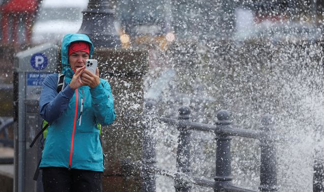
Heavy rain and winds of up to 75mph are set to batter the UK this week, affecting southern England on Wednesday evening, spreading northeast, and likely to persist until late on Thursday, according to the Met Office.
Storm Benjamin was named by the French weather service Meteo France, as the country is likely to be most affected by thunderstorms and strong winds.
The Met Office has not named the storm, but has issued yellow severe warnings for wind and rain for southern and eastern areas of England, and coastal areas of Wales.
What to expect?
"A powerful jet stream will drive a deep low-pressure system across the UK on Thursday, bringing heavy rain and strong winds to many areas," the British forecaster wrote in a post on X.
Those within the affected regions have been warned by the weather service to expect heavy rainfall from Wednesday evening, with up 50mm in some areas by early Thursday morning.
Check the weather forecast where you are
North Devon, Cornwall and the east of England could get even more rain, the Met Office added.
For the majority of the yellow alert area, gusts of up to 55mph are expected, with 65mph possible near coasts.
Widespread winds
Strong winds may lead to power cuts, transport disruption and damage to buildings with a small chance of injuries and danger to life caused by large waves and beach material being thrown on to seafronts and coastal roads, the forecaster warned.
Another yellow alert for wind on Thursday covers southwest England and parts of Wales, including Somerset, Devon, Cornwall, Swansea and Pembrokeshire.
Read more:
What are weather warnings and how do they work?
Why the weather has been gloomy in the UK recently
Gusts of up to 45mph are expected widely within this area, while winds of up to 60mph could be reached along exposed coasts and headlands, according to the forecaster.
"The low is deepening as it crosses the UK, it's likely to bring a swathe of strong winds as well, gales around southern and eastern coasts, the risk of 60mph gusts in some exposed spots, perhaps even a touch more in places," said Met Office meteorologist Aidan McGivern.
Before Wednesday, conditions are expected to be a "mix of bright spells and showers", he added.
The Met Office offered some advice for staying safe in strong wind, including protecting property from damage, preparing well before taking any journeys, driving safely, being wary of large waves and staying safe near cliffs along the coast and staying indoors as much as possible.

(c) Sky News 2025: Storm Benjamin to bring heavy rain and winds to parts of UK
 Inflation: Cost of living challenges require bold decisions
 'Don't tell anyone': Manager at UK's largest housing association told staff how to fake fire safety notice
 Shrinking herds and rising costs: The beef market is in turmoil - and inflation is spiralling
 Baby P's mother Tracey Connelly makes fresh bid for freedom
 Family of last woman to be hanged in Britain seek posthumous pardon

